
Our favourite places to stay on this sleepy Cebu island.
Our Mt. Marami Adventure: What You Need to Know Before the Climb

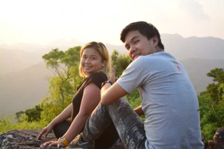
Contributed by A Wanderful Sole
Basic info
- Location: Maragondon, Cavite
- Jump-Off: Brgy. Ramirez, Magallanes Cavite or Brgy. Talipusngo Maragondon
- Elevation: 405+ MASL
- Difficulty: 3/9
- Features: Scenic view of Cavite and the nearby Pico De Loro
Mt. Marami is the less known counterpart of Pico De Loro. A distant mountain situated in Maragondon, she is less searched, less spoken of the two. Her trails are less beaten with only a handful of brave spirits come to walk through them. Her beauty is rarely a word of mouth nor a hot subject. It may be the case but her being less conceals an even awe-inspiring more. More challenging assaults that will make you drop to your knees. More hours of walking under a scorching sun. More off-beaten tracks to get lost to. More breathless moments and scenic views to fall in love with.
Also read: My Pico de Loro Ascent and What Every First Time Climber Should Know About
And on the side note, more and more cow’s poo.
The climb
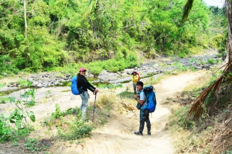
We started the trek way too late at 10.45am. The plan was we would be starting at 8. However, our (Boyfie and I) journey from Biñan Laguna which took us 2 hours, 4 jeepney rides and a tricycle made us arrive in McDonald’s Naic (Meet Up Place) 30 minutes after 7am. There we met with that day’s climbing buddies, Sir Migz and Donna. We then walked to the terminal with heavy bags on our backs (well, technically mine was small but still heavy) which took 10 minutes and waited for another 10 for the next available jeepney. The ride to Brgy. Ramirez could have just taken an hour but we all fell asleep and missed the jump off adding other good minutes to the time wasted but it was no biggie as it was still fun.
From the jump off at the main highway, we rode a trike going to Brgy. Ramirez registration site. After all the formalities were done, we then took off for the eventful day. We didn’t get a guide since Sir Migz frequents Mt. Marami and he knows it all too well crediting it to the time they (he and his group) were once lost in this magnificent mountain. Also, we were to stay overnight, meaning the guide would cost double than the usual price so heck NO!
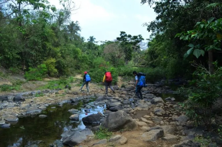
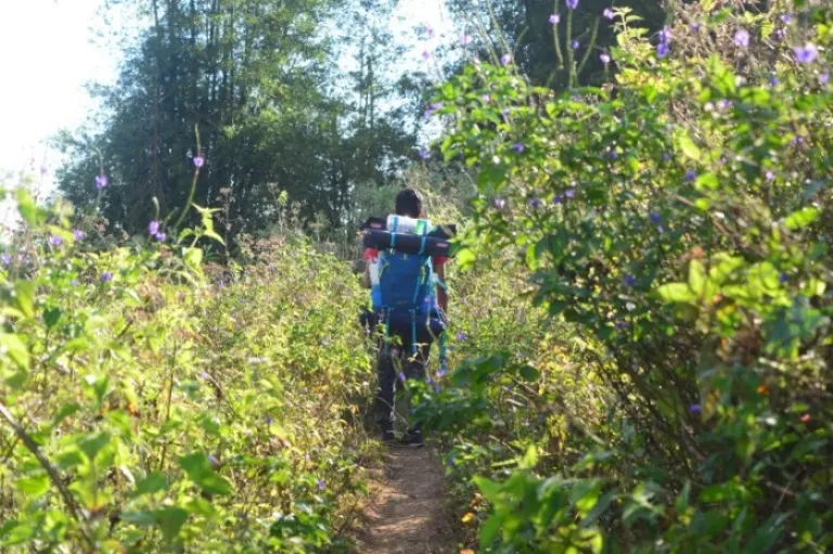
The first leg of the hike was through a concrete road passing by residential houses with probably every local asking why we had not secured a guide or if we would like to get one to which we politely declined. The concrete road ended and we then found ourselves walking along a dry, up and downhill dirt road until the long descent to the river which took approximately 15 minutes. We then walked along rocks up the trail leading to a spot where we crossed the almost dried up river. Upon crossing, that was when we first encountered a steep assault.
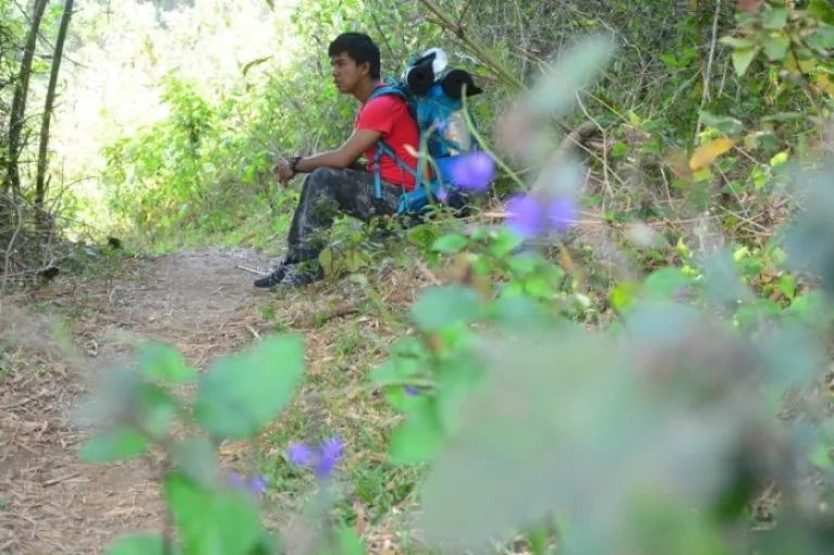
We overcame probably 3-4 assaults with walks over a flat surface and short descents in between before reaching a plain several metres up the river. The trail which was too exposed to the scorching midday sun added pressure to the hike with little air to bag for. Panting, we continued to walk further until we found a good resting place under a line of trees covering us from the punishing heat. It was 11:20am and what should have been a short breather became our lunch break. We indulged on whatever little comfort was on our plate for 30 minutes and when we were fully satiated, we resumed to take on the ordeal I never knew would last as long as forever.
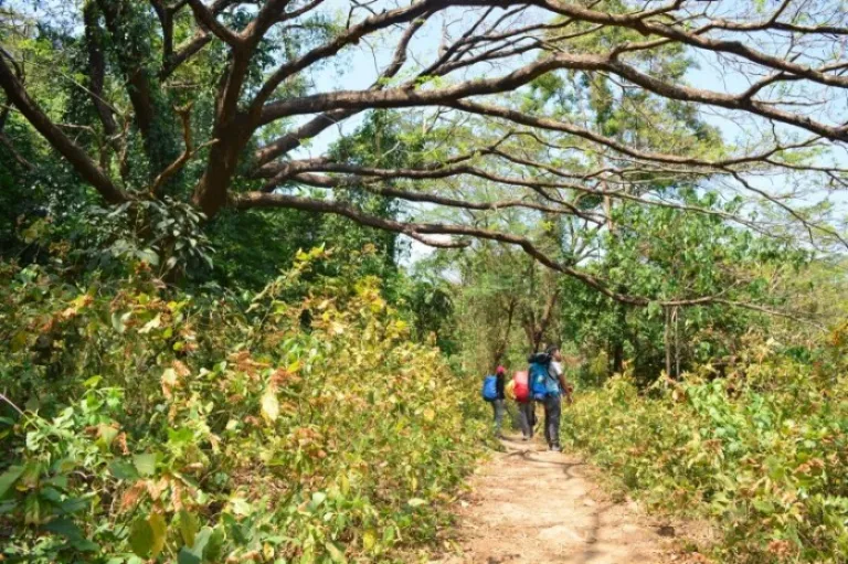
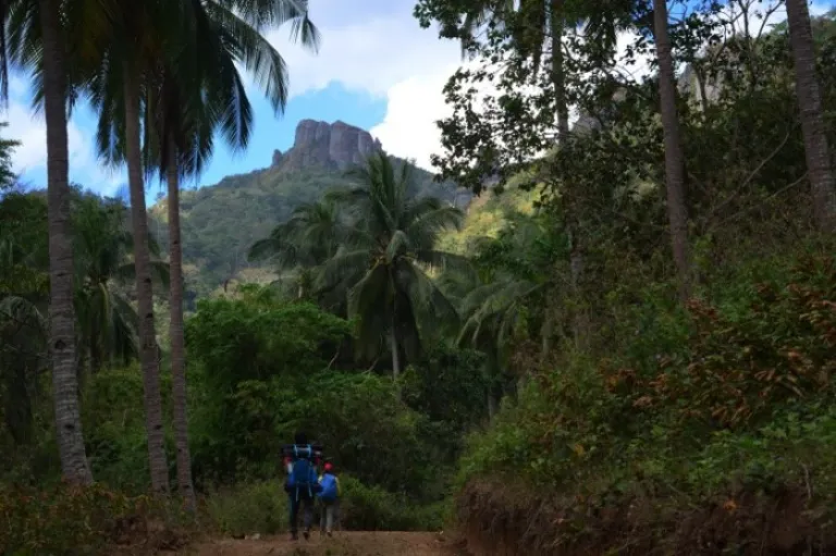
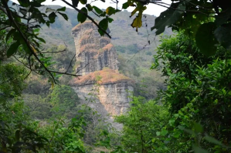
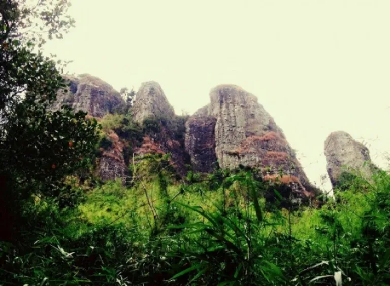
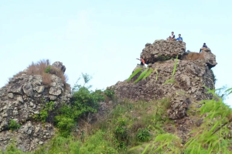
We walked until the end of the plain then quickly descended to a dirt road. We continued the up and downhill walk until we entered a woodland. The trail within the forest was just the same as the ones we just passed through. It probably took another hour before we came out of the forest and stumbled into a road which was too wide to be considered a trail with one of the trees bearing an arrow pointing to the left and a sign that says “This way to Mt. Marami.” There in the same spot I first saw Mt. Marami from afar with its summit and the so-called “Silyang Bato” seeming to sing to me to “Hurry Up!”
We rested for 10 minutes and I took the opportunity to snap me some photos. When we continued, just 5 minutes after we reached the 2nd registration point. We logged our names, paid the fees and spent another 15 minutes talking just about anything with the 2 locals who facilitated the registration. My watch said it was already 1.30pm but Sir Migz said we were actually still ahead of schedule so there was really no need to hasten up. I couldn’t believe my ears. I was wondering “How could we still be ahead of schedule when we have not done some good climbing yet, like we’ve not experienced the real stuff just yet?” Turns out, it’s just the way things are in this mountain. Long and lazy hours of walk along an up and downhill road in the middle of the day under the agonising sun. Sweet!
We resumed with the ordeal when we realised we have already overstayed. We went through the same up and downhill walk with some ascents and descents longer than the ones that came before. We passed by a small church, The Nuestra Senora Dela Paz commonly known to locals as “Nuestra” then went on further until we were already too exhausted and burnt up with that day’s seemingly endless boring routine. Not that it was in any way easy but it just wasn’t that exciting. We rested by the river and took comfort on chocolates and trail snacks. Afterwards we walked for a few good minutes before bumping into the first resting camp where a van and a car were parked and where we got ourselves “Buko Juice”.
It wasn’t really necessary for us to linger in that resting camp. We weren’t at all tired (maybe just me) cause we just rested. We weren’t hungry nor thirsty cause we just ate but we got ourselves “buko juices” anyway. Something just compelled us to sit and indulged again in hearty conversations with the locals. Perhaps it was to take a break from the madness of walking for hours without knowing how long does it still have to go on. Bonus was a group of blissful and funny youngsters caught up with us and made things even more interesting.
I didn’t want to move on just yet when Sir Migz decided to head on with the trek again. I still wanted to sit and talk! While following closely behind my climbing buddies, I was actually waiting for the funny bunch to catch up with us. We passed another resting camp but we didn’t drop by and continued with walking until we reached the end of the road where a residential hut stood with an old owner-type jeep parked in front.
We approached the local woman who was resting in the hut along with her 2 kids. Sir Migz asked her instructions as he was kind of bothered whether we were still on the right track. He said the roads were kind of different from the way it was the last time he was there so he just needed confirmation. The woman was not much of help since she has not really climbed all the way to the top of the mountain. She sent for her husband who arrived minutes later. He too was not much of help as he could not really confirm what Sir Migz was trying to ask them. The clock was quickly approaching the hour of 3pm and we needed the answers quick else we won’t make it to the summit in time for the sunset or even before dark.
Just when we were about to take off relying only on our intuition, the long haired guy from the registration area came and told us to take the trail at the back of the hut as it was easier and will only take an hour and a half to the summit. We were kind of skeptical about it but Kuya Long Hair was so persuasive, he finally convinced us.
We took a few minutes more to recharge and refill our water bottles. When we were all set, we headed on to take on the real stuff that I was waiting for, for 5 effing hours! The clock just hit 3pm so if Kuya Long Hair was true to his words, we would still make it to the summit before dark and we would still have plenty of time before the sunset. We walked passed the hut continuing to a narrow stream which we crossed to get to the mouth of the trail. We might have been told that this trail would take us to the summit swiftly but what they failed to warn us about was that it was too steep and a straightforward assault to the peak.
Few yards from where we started, I was already running out of breath. What baffled me was how bushy the trail was. Branches of trees grow overhead. Dried leaves were scattered everywhere almost obscuring the path. All along I was thinking “If this is the trail hikers regularly take to hike up the summit, why does it look as if no one has ever dared set foot on it for ages?”. Oversized mosquitoes were also swarming over us, bothering us whenever we would take short breathers. The strenuous climb took its toll early on and barely halfway to the summit, Ian was almost to give up due to too much exhaustion brought about by the heavy backpack he was carrying since the start of this entire ordeal. I offered to take the bag from him asking to support me while we hike up but he refused. Just before matters become heated, Sir Migz made a conscious effort to leave us to settle things and went ahead together with Donna, reminding us to follow closely after we rest.
Ian and I resumed the trek, pacing a bit slower without compromising that day’s goal, “The Summit Sunset”. Despite the assault becoming ever more difficult, we refused to give up pushing and motivating each other even when things were slowly becoming impossible. I couldn’t remember the number of times we stopped for short breathers before and after every painful assault but we held on.
From the woody forest to overgrown vegetation, the scene quickly shifted into a bamboo forest without us even noticing. What remained in my memory was the first time I first had a glimpse of the skies, the almost setting sun, the surrounding mountains and the view of the infamous “Silyang Bato” up close which invigorated my soul as it was evidence that the summit was already within our reach.
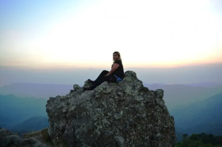
The last leg of the hike was the most taxing which consisted of bamboo tunnels, steeper assaults, more obscured trails, a rock climb to the final stretch and a deadly hop from one cliff to the other that was over a meter apart. That cliff hop got my knees trembling like crazy but I managed to do it after several attempts of counting 1-2-3 with the jump to the end but I would freeze like hell come 3! I still haven’t figured out how I was able to overcome every ounce of difficulty in time before the breathtaking sunset but I was just glad with being able to conquer myself and my hopelessness before the seemingly without end nightmare.
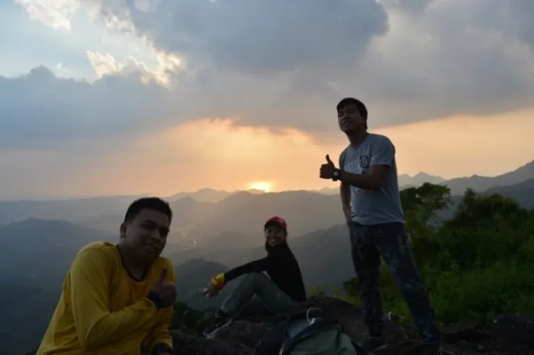
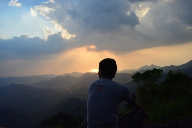
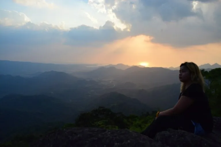
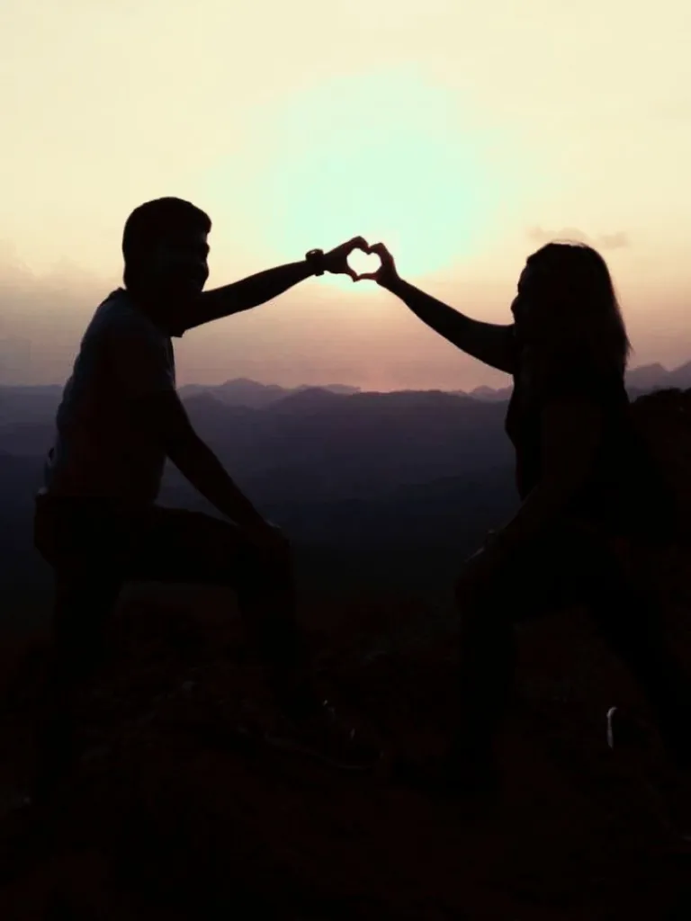
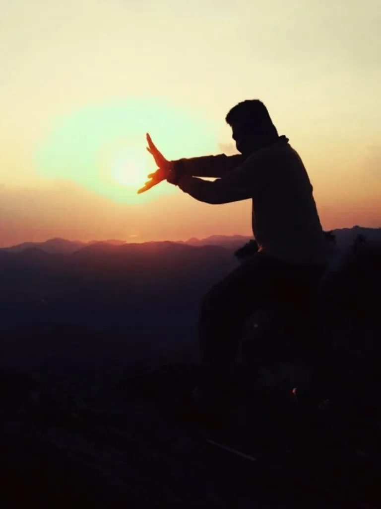
I don’t know but I considered us making it to the peak just minutes before the setting sun a miracle. It was such a blessing. I might have broken every inch of my bones during the arduous assaults and torn my muscles in each effort I had exerted but that seemed to vanish when I found myself sitting in one of the rocks at the summit and staring at the panoramic view of the skies, the outlying mountains and the sea from afar with the sun sitting atop the distant horizon and with their colours colliding harmoniously creating an inexplicable beauty that was way beyond perfect to cap off the day.
Also read: Top 10 Mountains in Philippines With the Most Incredible Views
The descent to the campsite and the stunning night scene
We took a different route and started the descent minutes after the sun finally vanished behind the horizon. The sun may have already given way for the night but its light stayed for several moments more. Plus, the moon which has taken centre stage was also shining at her brightest that night making the descent less of an effort although we still had our headlamps and flashlights on as precaution.
The first part of the descent was through a 90-degree walls of rocks. After that is a descent through an eroded trail for several metres where you will need to scour for things you can hold on to as one miss will get you rolling your way down and earn you bruises and if you are that lucky, a disjointed knee. Upon overcoming those 2, everything seemed to be a walk in the park like literally it got me thinking why haven’t we taken this route on our way up. We reached the campsite after probably 10-15 minutes where we pitched our tents and prepped up for dinner.
While waiting for dinner to get served, I marvelled at the moon shining so bright on a clear night sky dotted with several stars. I would have loved to see a milky way but the moon pretty much compensated for that. In the far-flung mountains were Tagaytay and the usual city lights. Planes flew overhead with its engine resonating on the entire mountain. The air became colder as time went deeper into the night. When dinner was ready, we feasted heartily as if it was our first to have eaten that day! We had a brief talk as bed was calling too early and we were too beaten up by this eventful day so before the hour hit 8pm, each was off to a snoring spree. 😀
The unexpected morning sea of clouds and the overly speedy descent
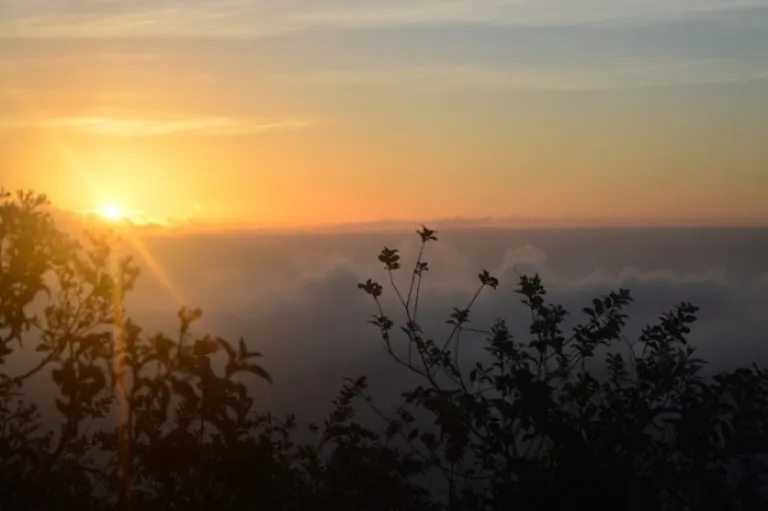
I woke up to the voice of Sir Migz and his gentle pounding on our tents. He was like excited to show us something! Turns out he was marvelling at something he hasn’t seen before in the many times he has climbed Mt. Marami. It was 5.30am and the sun hasn’t risen the horizon yet. When I got out of our tent, I was amazed to see fluffy white clouds engulfing the entire mountain. I quickly grabbed my camera to snap me the most awesome memory I can keep of Mt. Marami. The sun came and what my eyes have witnessed was totally extraordinary! It was never short of stunning! Orange skies battling the blues over gentle white clouds. Epic!
The sun has quickly crawled up the sky chasing away the cold morning breeze and replacing it with his warmth. Our breakfast was over a slice of bread and coffee. When we were filled, we broke camp, packed up and started the descent. I couldn’t really help but think that if this was the route we had taken yesterday to the summit, we could have avoided the trauma we experienced. The descent was just a breeze and if I would put it in reverse, it wouldn’t be that hard either. More walks over a flat surface. Not much of aching assaults! Puff! We even made it all the way down for just a little over an hour given how slowly we’ve walked and how long we had stalled after I slipped and fell down! All those times I was thinking, “Kuya Long Hair will really get some good scolding from me! I swear!”
My 50 cents and other info
We didn’t plan a traverse but after we did, I realised it was worth it. The trail we had taken to the summit was the old trail mountaineers normally took before it was destroyed by the typhoon and was just recently restored by Mt. Marami’s caretaker. It is located at the end of the road at the back of the house several metres passed the so-called Talahib trail and approaches the summit from the west. The other trail, also called the Talahib Trail on the other hand is a lot easier. It is the one that hikers nowadays take to hike to the summit and approached it from the east. It is an open trail, too exposed to the sun if you come to start the trek late but offers more stunning views during the hike.
The roads to the foot of Mt. Marami is now being paved which I can’t tell whether a bad or a good thing. Good is hiking would be cut down to just 2-3 hours as there won’t be a need for long walks due to easier access. Bad is easier access means influx of hikers which might destroy the mountain. I hope when the roads get done, the local officials would limit the number of hikers to barely a hundred everyday most especially on weekends.
Since we were too lazy to walk back to Brgy. Ramirez, we took the service of Kuya “can’t remember his name but he is the caretaker of the mountain” to drive us to the jeepney terminal bound for Amuyong! We paid a whopping ₱800. If you happen to be feeling lazy walking back after the trek, I suggest that you endure. Please don’t patronise this overpriced service! If only Ian was feeling well, we would still choose the walk all the way back!
How to go there
Commute – Ride a bus in coastal mall going to Naic, Cavite and alight the bus at Jollibee Naic. Walk to the terminal bound for Magallanes. Ride one and get off at the jump off to Brgy. Ramirez. From there, ride a trike going to Brgy. Ramirez registration office. Alternatively, you can ride a bus going to Nasugbu, Batangas and alight in the intersection at the side of Amuyong School. Ride a jeep going to Brgy. Ramirez in Magallanes jump off point then take a trike to the registration office.
Private – Take the highways going to Tagaytay continuing to Nasugbu. Turn right to the highway before Amuyong School then follow your way until Brgy. Talipusngo. Turn to the left with a sign to Mt. Marami and drive your way from the concrete road, to rough and rocky dirt road passing by shallow rivers like there was 3 of them until you reach the first “Kubo” passed the Nuestra.
Summary of expenses
- RT Fare Mla-Naic – ₱120
- RT Fare Naic-Brgy. Ramirez – ₱80
- RT Fare Trike – ₱40
- Guide Fee (Day hike) @ ₱500 – ₱100
- Environmental Fee (Ramirez & Maragondon) – ₱40
- TOTAL – ₱380/pax for a group of 5
Note: I did not include the driving service as I don’t recommend it.
Things to bring
- 3L Water (1.5L trail water & 1.5L camp water)
- Tent and tent lamps
- Jacket
- Change Clothes
- Packed Lunch
- 2-3 canned goods (Tuna/corned beef, spam/ luncheon meat)
- 1 cup rice
- Food containers
- First Aid Kit inc Personal Meds
- Sunblock
- Insect Repellent
- Kikay kit/Toiletries
- Wet Wipes/Paper Towels
- Waterproofing items (Large plastic bags/Ziplock bags)
- Food utensils
- Poncho
- Bush hat
- Umbrella
- Extra Cash
- Camera with extra battery
- Headlamps &/or Flashlights
- Trash Bag (Leave No Trace)
Sample itinerary
Overnight (Back Trail – Talahib Trail)
Day 1
0500H Meetup Mcdo Naic
0600H Board Jeep going to Brgy. Ramirez Magallanes Cavite
0700H Arrive at Jump off point , Brgy Ramirez
0715H Start Trek
0830H Arrive at rough road
0930H Arrive at Nuestra (Rest 15mins)
0945H Resume trek
1000H Arrive at Kubo
1030H Arrive at Selected Campsite (setup camp) Rest
1100H Eat/Prepare lunch rest
1600H Prepare summit assault, photo ops of sunset
1800H Descent from summit
1900H Back to Camp prepare dinner/socials
2200H Lights out
Day 2
0400H Wakeup call/Prepare breakfast and packed lunch
0600H Break camp
0630H Start Descent to Talahib trail
Day hike (Back Trail Talahib)
0400H Meetup Mcdo Naic
0500H Board Jeep going to Brgy. Ramirez Magallanes Cavite
0600H Arrive at Jump off point , Brgy Ramirez
0615H Start Trek
0730H Arrive at rough road
0830H Arrive at Nuestra (Rest 15mins)
0845H Resume trek
0900H Arrive at Kubo
1100H Summit/Photo Ops
1200H Descent from summit
1400H Arrive at Kubo/Lunch
1500H Trek Back to Brgy Ramirez
1700H Brgy Ramirez/Wash up
1800H Home Bound
Traverse day hike and overnight (Old-Talahib Trails)
Day 1
0500H Meetup Mcdo Naic
0600H Board Jeep going to Brgy. Ramirez Magallanes Cavite
0700H Arrive at Jump off point , Brgy Ramirez
0715H Start Trek
0830H Arrive at rough road
0930H Arrive at Nuestra (Rest 15mins)
0945H Resume trek
1000H Arrive at Kubo at the end of the road
1030H Rest
1100H Eat/Prepare lunch/Rest
1430H Prepare summit assault/Start Trek
1700H Summit/Photo Ops
1800H Descent to Campsite/Set Up Tents/Prep Dinner/Socials
2200H Lights out
Day 2
0400H Wakeup call/Prep breakfast and packed lunch
0600H Break Camp
0630H Start Descent to Talahib trail
Also read: Mount Batulao Guide: What You Need to Know Before Your Hike
Note: Just adjust the time for those doing day hike traverse.
There you go! I hope you love my Mt. Marami story and I would love to hear yours after you get there. Until next time. Ciao!
Published at
About Author
Subscribe our Newsletter
Get our weekly tips and travel news!
Recommended Articles
10 Bantayan Island Resorts, Hotels, and Rentals for Your Tropical Escape 10 Best Mountain Cafes in the Philippines for Your Peak Coffee Experience Coffee date on the mountains, anyone?
10 Commandments for Responsible Travel Flexing Spread the good word!
10 Fairytale Castles In Europe Filipinos Need To See! Permission to feel like royalty even for a day?!
10 Family Outing Ideas in Metro Manila Under ₱500 Looking for a weekend bonding with the family under ₱500? Head to these places, pronto!
Latest Articles
Lee Jun-hyuk Finds His Favourite View in the Philippines A heartfelt moment from his Manila fan meet
Gen Z Pinoys Are Creating Travel-Smart Apps for Daily Life Tech meets everyday travel
Cebu Pacific Flight to Tawi Tawi Returns to Zamboanga Due to Technical Issue Flight delay due to safety check
Explore Marawi: The Filming Location of Incognito’s Intense Last Mission Discover why Marawi City was chosen as the powerful filming location for Incognito’s explosive finale. A real-world setting that brings depth to the action and a spotlight to Mindanao.
How to Explore Chongqing, China: A Guide for Filipinos Hotpot, Cable Cars, Culture, and More!